Raymarine
CMOR Mapping
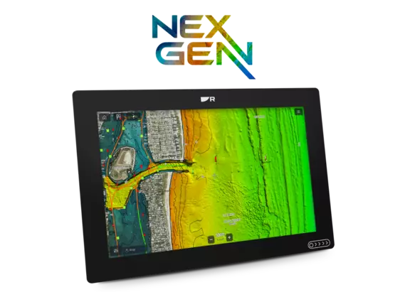
Experience the ocean floor like never before. CMOR Mapping’s high‑resolution bathymetric imagery with full navigational data and satellite imagery integrates seamlessly with Raymarine Axiom chartplotters, giving anglers and divers an unprecedented view beneath the surface.

High‑Resolution Seafloor Mapping
Experience the ocean floor like never before. CMOR Mapping’s high‑resolution bathymetric imagery with full navigational data and satellite imagery integrates seamlessly with Raymarine Axiom chartplotters, giving anglers and divers an unprecedented view beneath the surface. CMOR Mapping charts are built from meticulous, high‑density surveys using advanced echosounders, not sparse point data or outdated historical records. The result is a complete, highly accurate representation of the bottom structure. The charts available from CMOR include full coverage for the entire state of Florida. Along with additional Florida coverage, CMOR NEX GEN South Atlantic V2 also covers the coastal areas of Georgia and South Carolina. With resolution down to 1 meter, CMOR reveals every ledge, ridge, coral head and hidden piece of structure with exceptional clarity. Each pixel represents a single square mete
Gallery
No list prices — tailored quotes only
Quote the
CMOR Mapping
Tell us your vessel and helm layout. Our marine team replies within one business day with availability, compatible accessories and lead times.