
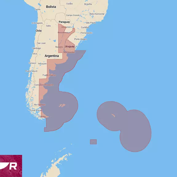
Argentina & Uruguay
Preloaded microSD card with coverage of the waters of Uruguay, Argentina and Falkland (Malvinas) Islands. Inland waters are partially included.
Raymarine
Explore without limits with superior marine charts for Raymarine Axiom and Element chartplotters.
Preloaded microSD card with coverage of the waters of Uruguay, Argentina and Falkland (Malvinas) Islands. Inland waters are partially included.

Preloaded microSD card with coverage for entire shoreline of Australia, Tasmania, Melville, Kangaroo, Christmas Island and Cocus (Keeling) + 8,000 islands, New Zealand + 600 islands, South Pacific Islands, Papua New Guinea, Solomon Islands, New Caledonia, Vanuatu, and Timor-Leste.
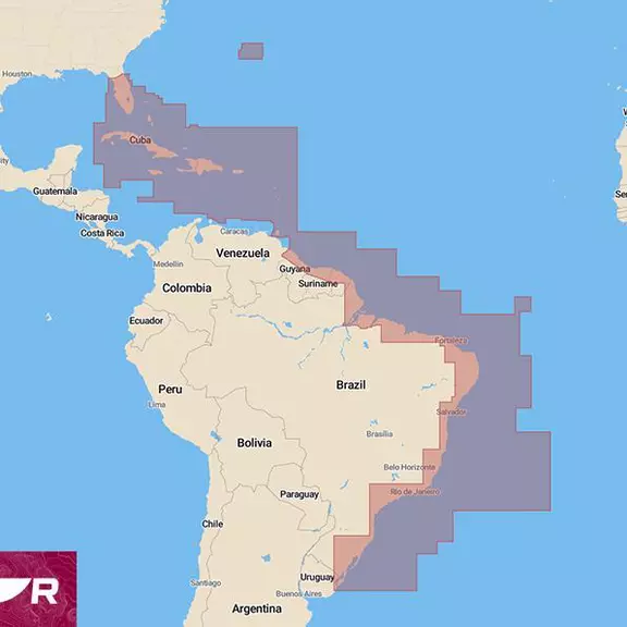
Preloaded microSD card with coverage for Gulf of Mexico, South of Florida, Bahamas, Caribbean Islands and the entire coastline of Brazil.
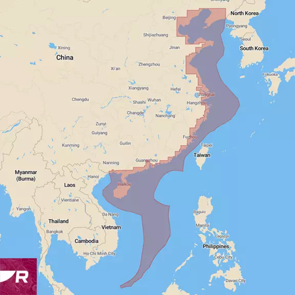
Preloaded microSD card with coverage of the waters of China and Hong Kong. Yangtze River and other inland waters are not included.
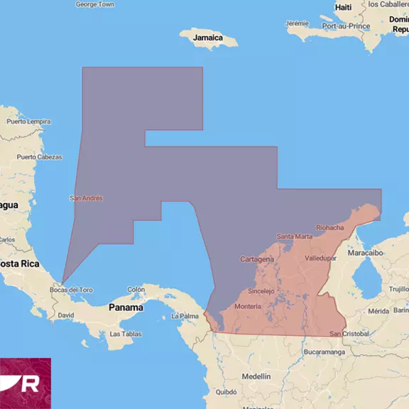
Preloaded microSD card with coverage of the waters of the Colombia Caribbean
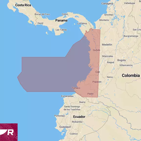
Preloaded microSD card with coverage of the waters of the Colombia Pacific Sea
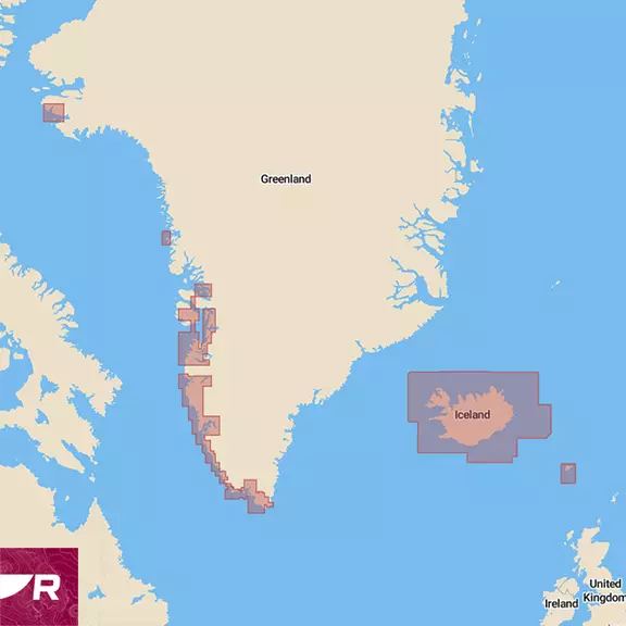
Preloaded microSD card with coverage of Iceland, Faroe Islands and Greenland (partial coverage of the West coast and South only).
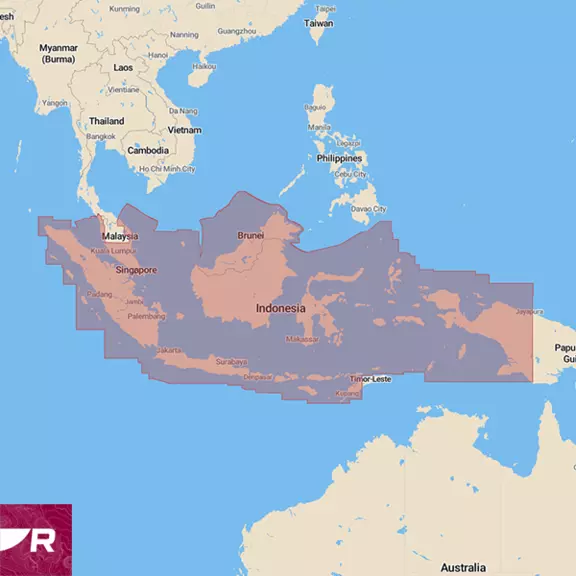
Preloaded microSD card with coverage of the waters of Indonesia, Malaysia and Brunei Darussalam.
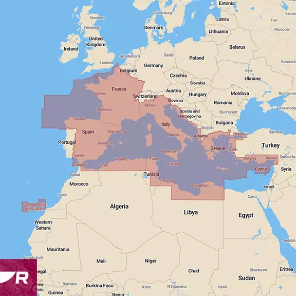
Preloaded microSD card with coverage for the Mediterranean including Spain, France, Italy, Malta, Croatia, Slovenia, Montenegro, Morocco, Algeria, Tunisia, Libya, Greece, Turkey, and Cyprus.
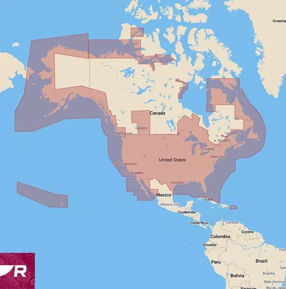
Preloaded microSD card with coverage for coastlines of the contiguous U.S., Alaska, Hawaii, Canada, U.S. Virgin Islands, Puerto Rico and Bahamas. Also includes the Great Lakes and thousands of inland freshwater bodies of water.
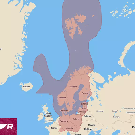
Preloaded microSD card with coverage for Northern Europe including Norway, Sweden, Finland, Estonia, Latvia, Lithuania, Poland, Germany, Denmark, Switzerland, Austria, Czechia, Hungary, Slovakia.
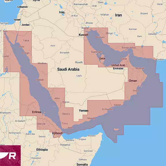
Preloaded microSD card with coverage for coastlines of Egypt, Saudi Arabia, Sudan, Eritrea, Djibouti, Yeman, Oman, UAE, Qatar, Bahrein, Kuwait and Iran (Persian Gulf only).
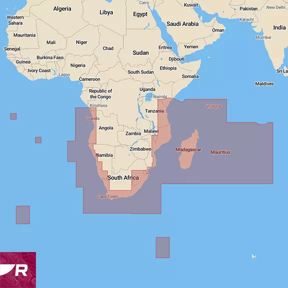
Preloaded microSD card with coverage for South Africa including Namibia, Angola, Mozambique, Tanzania, Kenya, Madagascar, Seychelles, Comoros, Mayotte, Mauritius, Reunion and the islands of St. Helena, Ascension and Tristan da Cunha in the South Atlantic Ocean.
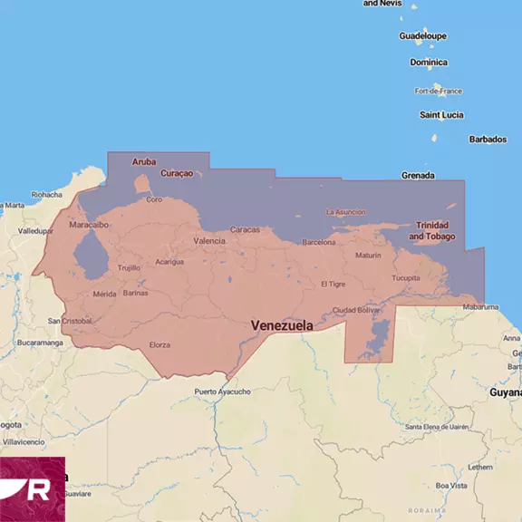
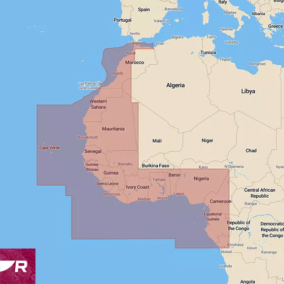
Preloaded microSD card with coverage for Morocco, Mauritania, Senegal, Cabo Verde, The Gambia, Guinea-Bissau, Guinea, Sierra Leone, Liberia, Côte d'Ivoire, Ghana, Togo, Benin, Nigeria, Cameroon, Equatorial Guinea, Gabon, São Tomé and Príncipe, Republic of the Congo, Democratic Republic of the Congo.
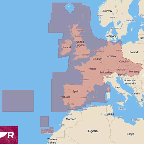
Preloaded microSD card with coverage for Western Europe including Ireland, Great Britain, Portugal, Spain, France, Germany, Switzerland, Austria, Netherlands, Belgium, Czechia, Hungary, and Slovakia.
LightHouse Charts GEN 2 for Raymarine Axiom and Element deliver faster redraw speeds, expanded coverage and easier chart updates. Trust LightHouse Charts GEN 2 for superior readability and intuitive navigation. We create LightHouse Charts GEN 2 regions from official hydrographic chart sources—the same data trusted by maritime professionals. New chart regions are added regularly, and existing charts are frequently updated to reflect changes in coastline, hazards and marine infrastructure.
Nautical Charts / LightHouse Chart North America Preloaded microSD card with coverage for coastlines of the contiguous U.S., Alaska, Hawaii, Canada, U.S. Virgin Islands, Puerto Rico and Bahamas. Also includes the Great Lakes and thousands of inland freshwater bodies of water.]( New Nautical Charts / LightHouse Chart Western Europe Preloaded microSD card with coverage for Western Europe including Ireland, Great Britain, Portugal, Spain, France, Germany, Switzerland, Austria, Netherlands, Belgium, Czechia, Hungary, and Slovakia. New Nautical Charts / LightHouse Chart Northern Europe Preloaded microSD card with coverage for Northern Europe including Norway, Sweden, Finland, Estonia, Latvia, Lithuania, Poland, Germany, Denmark, Switzerland, Austria, Czechia, Hungary, Slovakia. [New Nautical Charts / LightHouse Chart Mediterranean Preloaded microSD card with coverage for the
Quickly find local marinas, fuel stops, service stations, and more with an ever-expanding points of interest library sourced from leading providers.
Do you have questions? Well, we may have the answers you are looking for. Below you'll find answers to the most common questions we get asked about LightHouse charts. If you still can't find the answer you're looking for, just contact us. How can I create an Account for the Chartstore? Go to the chartstore: and click on "Create an account" in the top right corner. On which devices can I use LightHouse Charts? LightHouse Charts are compatible with all Axiom and Element Chartplotters only. Where can I buy a LightHouse chart? You can purchase a chart from your local dealer. You can use our dealer locator here. The 'Find a dealer' tool is available in all supported languages so please check your language settings on raymarine.com How do I know if my area is covered by the LightHouse Chart? Please visit the Chart Catalog and click on "View Details". If
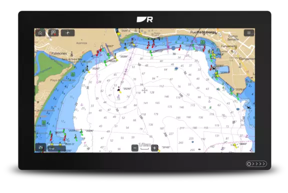
Navigate, zoom and explore with LightHouse Charts GEN 2
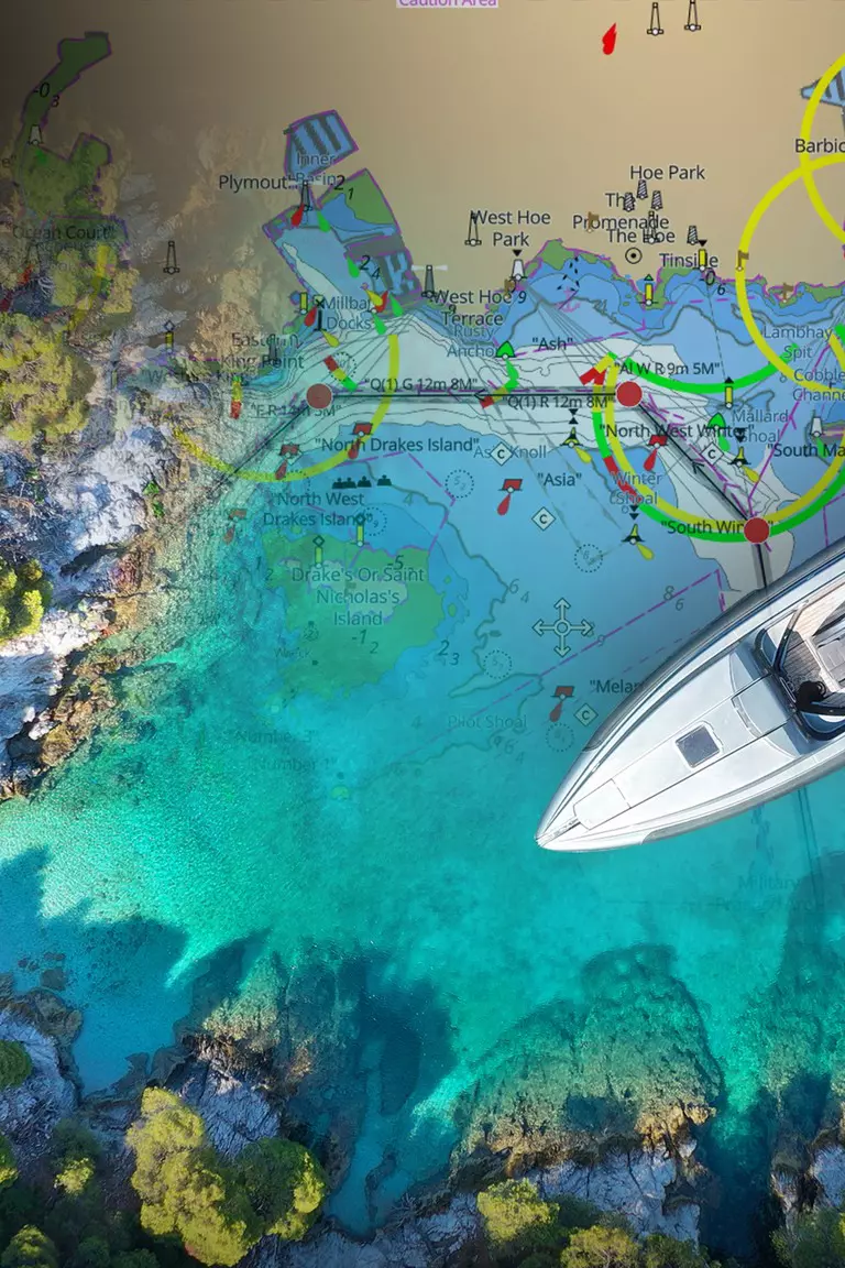
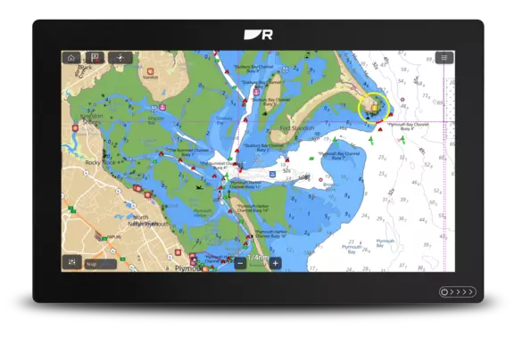
GEN 2 charts offer expanded coverage, , lakes, rivers and harbor enhancements
Downloading updates and LightHouse Premium data is now download times
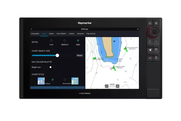
Change the size of channel markers, points of interest, and other icons for complete control over chart details.
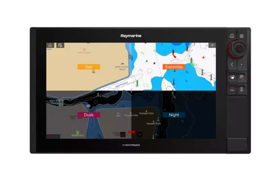
Day, SuperDay, Dusk and Night color palettes help your vision keep up with changing light conditions for clear, strain-free chart viewing.
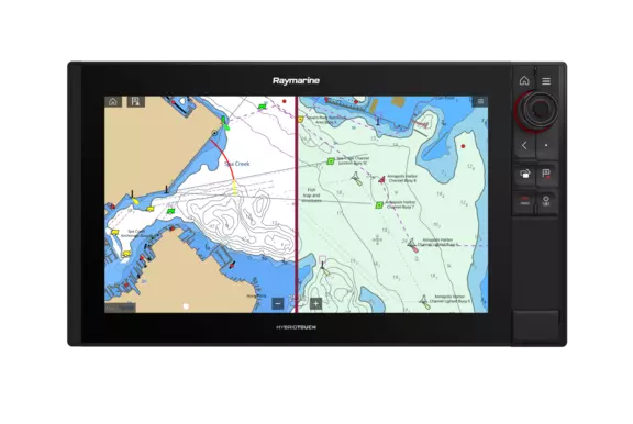
Toggle between the information-rich LightHouse Leisure Chart style and the professional S-52 Government Chart style for your preferred view of key cartographic data.
No list prices — tailored quotes only
Tell us your vessel and helm layout. Our marine team replies within one business day with availability, compatible accessories and lead times.